1. 1810 – 1910 Discovery and Utilization
2. 1911 – 1948 Establishment of Scientific Outposts
3. 1948 – PRESENT Modern Uses
1810 – 1920 Discovery and Utilization
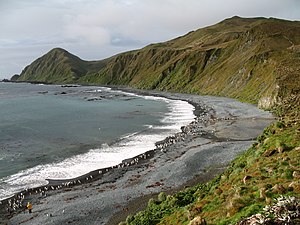
Macquarie was discovered in 1810 by Captain Frederick Hasselborough who was exclusively concerned with the island’s large seal population and its potential use in the production of seal oil.[i] Though the island was generally considered unremarkable, and not suitable for human colonization its fauna created incentive for the oil industry. At one point during the island’s early years even penguins were utilized for oil—each penguin yielding approximately ½ liter of oil.[ii] The industrial commoditization of the extant wildlife decimated the local populations.
PENGUIN OIL INDUSTRY
The Tasmanian government has provided an extensive resource on the history and impact of sealing and the use of penguins for oil here.
1911 – 1948 Establishment of Scientific Outposts
Concurrent with the industrial utilization of Macquarie Island, many scientists had begun to find interest in the island, specifically for its proximity to Antarctica and the prevailing weather systems that effected nations directly to the north. That interest eventually led to the creation of the islands first permanent meteorological station in 1911 by Australian Sir Douglas Mawson.[iii] The station was in operation only for 4 years. It was closed in 1915 after the complete loss of the aid ship Endeavour.[iv]
During their time on the island the observers also closely documented the remnants of the sealing community and the effects of the oil industry on the penguin population. Their observations of, and subsequent testimony against, eventually ended the use of Macquarie Island wildlife as a source of oil.[v]
In 1933 the Tasmanian government established the island as a wildlife sanctuary.[vi]
1948 – PRESENT Modern Uses
In March 1948 the Australian National Antarctic Research Expedition (ANARE) established the present research station on the island at Buckles Bay.[vii] The purpose of the station was to begin weather research operations in an effort to understand Antarctic weather systems that influence Australian weather. The Macquarie Island Meteorological Office has provided an uninterrupted stream of data from the time of its creation.
MACQUARIE ISLAND METEOROLOGICAL STATION

The Australian Antarctic Division, under a lease from the Tasmanian government, operates the modern research station.
To view a webcam of the island from the research station, click here.
REFERENCES USED
[i] http://www.aad.gov.au/default.asp?casid=29579
[ii] Ibid.
[iii] http://www.aad.gov.au/default.asp?casid=29582
[iv] http://www.bom.gov.au/weather/ant/macquarie/history.shtml
[v] http://www.parks.tas.gov.au/index.aspx?base=1834
[vi] http://www.parks.tas.gov.au/index.aspx?base=626
[vii] http://www.bom.gov.au/weather/ant/macquarie/history.shtml
.jpg)